Two projects, two very different clocks
The drive onto Cape Cod and the drive through downtown Hyannis are headed for changes on very different scales. At the canal, the Sagamore replacement leads a multibillion-dollar program to replace the two highway crossings. In Hyannis, Great Streets will undo familiar one-way routes and reshape the way people reach Main Street, its businesses and the harbor.
Both projects reach back into decisions made long before today’s commuters and visitors got behind the wheel. Both involve more than pavement. They also involve public money, local access, construction disruption and the question of what kind of travel the Cape should make easier.
Here is where they stand on October 28, 2026, with the funding categories and schedule uncertainties kept visible.
Sources: Regional program overview, Current town project page
Why the 1935 bridges still define the Cape
The Cape Cod Canal opened as a privately operated toll waterway on July 29, 1914. Its early movable bridges created a problem for vessels navigating a narrow channel and strong currents while waiting for a span to open. Federal operation began in 1928, followed by a major rebuilding of the waterway.
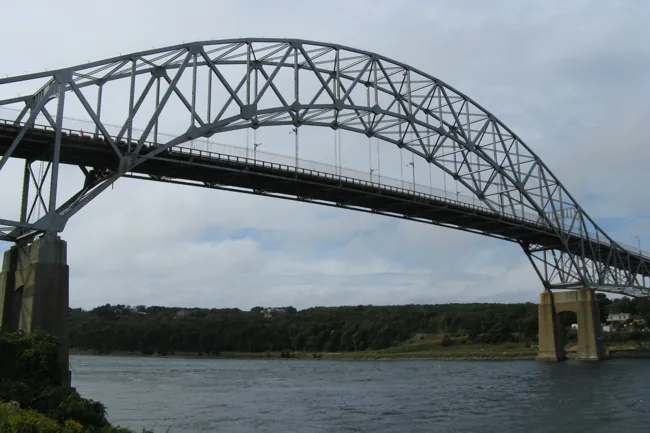
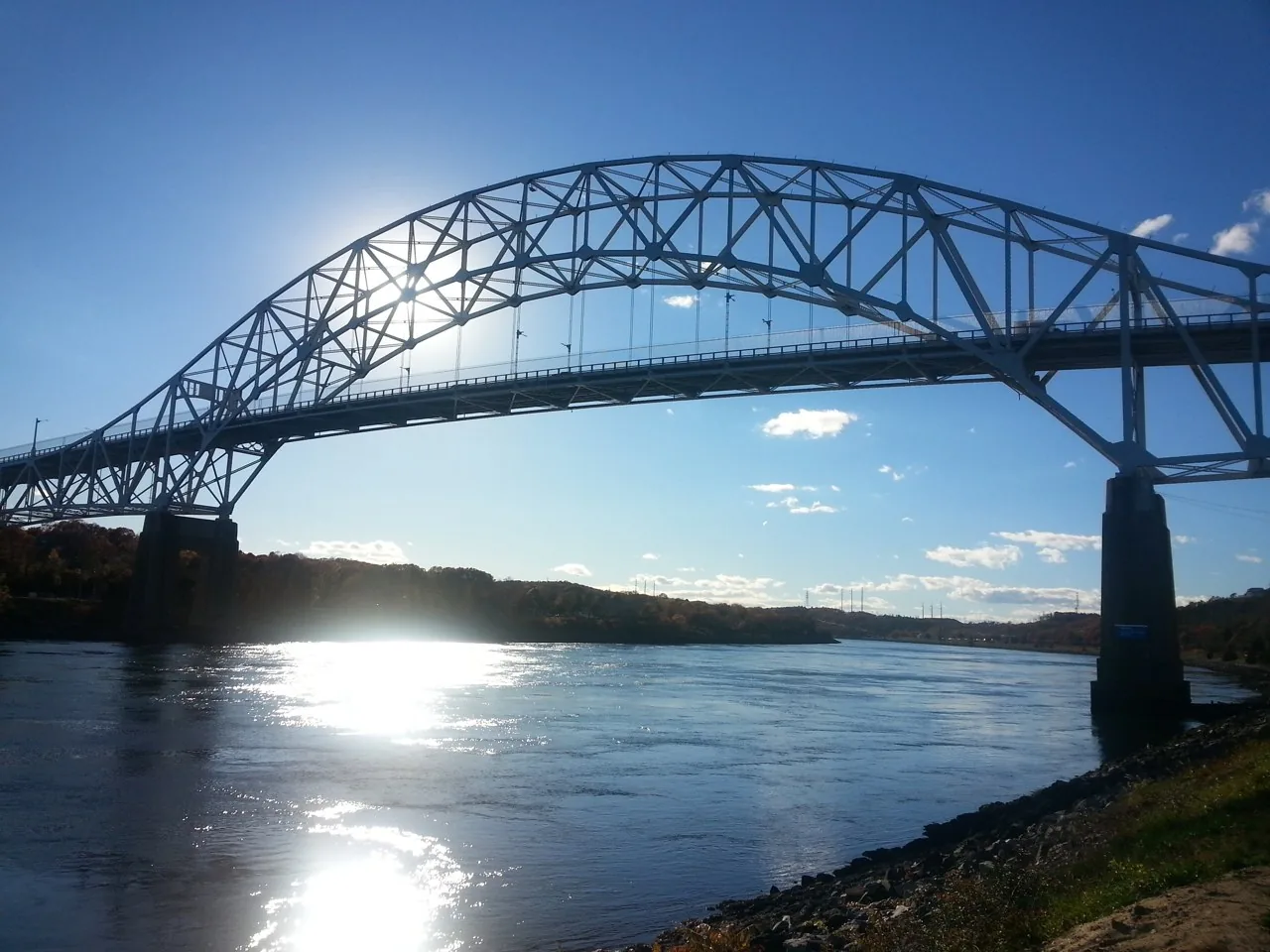
The Army Corps chose naturally elevated sites for fixed highway crossings. The Sagamore and Bourne bridges opened on June 22, 1935, with 616-foot main spans and 135 feet of clearance above high water. The lift railroad bridge was a separate part of the same era’s transformation.
The Corps’ history records $4.6 million in 1933 federal funding for the three bridges and other canal improvements, with roughly 700 workers employed on bridge construction during the Depression. That historical appropriation covered a different scope in a different economy; it is not a like-for-like benchmark for the modern replacements.
The familiar steel crossings are now 91 years old. Their longevity explains their place in Cape life—and why replacement has become a generational undertaking.
Sources: Corps canal history
Why replacement won over another major repair
The Army Corps’ rehabilitation study compared continued routine maintenance, major rehabilitation and replacement. Its evaluation considered structural reliability, risk and economic effects. On April 3, 2020, the Corps and the Assistant Secretary of the Army for Civil Works chose replacement as the stronger long-term investment.
That distinction matters. The present undertaking follows a comparison of alternatives; it is not simply a proposal to freshen the appearance of two landmarks. The existing crossings must keep serving the Cape while their successors are designed and built. A replacement decision also does not mean that every funding award, permit, construction contract or traffic arrangement for both crossings has already been completed.
Sources: 2020 replacement decision
What the new Sagamore crossing will look like
The proposed crossing uses two parallel steel network tied-arch structures, one for each direction. Each has two 12-foot through lanes and a 12-foot auxiliary merging lane. That extra lane supports entering and exiting traffic; it is not a third continuous through lane beyond the interchanges. Modern shoulders provide additional space, and the Cape-bound structure includes a separated, 14-foot shared-use path.
MassDOT’s construction concept calls for approach spans built on land and arch spans fabricated away from the crossing, then floated in and lifted into place. Staging the work around twin structures is intended to keep two lanes available in each direction while construction proceeds. The program also includes approach-road and walking/cycling connections, rather than ending at the steelwork over the water.
The agency describes a 100-year expected lifespan for the new bridges. That is a design expectation, not a promise that they will need no maintenance or that summer congestion will disappear.
Sources: Current bridge FAQ, Bridge design and staging
Sagamore’s $2.144 billion funding package—and the gas-line bill
The July 23, 2026 MassDOT hearing presentation calls the Sagamore project fully funded and lists the following rounded funding amounts.
| Funding source | Amount |
|---|---|
| Federal Mega grant | $372 million |
| Federal Bridge Investment Program | $993 million |
| U.S. Army Corps of Engineers | $350 million |
| Massachusetts bond funds | $429 million |
| Listed total | $2.144 billion |
A footnote separately identifies $302 million from Massachusetts for gas-line relocations. The $2.144 billion table therefore should not be described as an all-in total that includes those relocations. Nor should older announcements of a $700 million state commitment be stacked on top of the later state funding lines as if they were a fresh award.
These are project funding figures. A competitive construction price, eventual changes and final expenditure are separate questions.
Sources: July bridge funding and schedule
What the September $956 million announcement means
On September 28, Massachusetts announced federal authorization of $956 million toward Sagamore construction. Chatham’s official project update identifies this as previously awarded Bridge Investment Program funding. It should not be counted as another $956 million on top of the July package. The state announcement also said another $371 million was expected to be authorized in mid-October.
The materials checked for this feature still describe that latter authorization as expected. We have not verified a later confirmation that it occurred, and a date having passed is not evidence that money was released.
The current MassDOT FAQ records a September 24 request for proposals to three shortlisted teams. The state announcement anticipates final proposals in May 2027 and a public bid opening in July. Those procurement steps help explain why a funding milestone is not the same as a completed construction contract.
Sources: September federal authorization, Previously awarded bridge funds, Current bridge FAQ
The bridge timeline: first traffic in 2033, more work afterward
MassDOT’s current hearing FAQ anticipates a design-build notice to proceed in late 2027 and major construction beginning in spring 2028. That is more specific than the September announcement’s reference to winter 2027. Readers should distinguish contract authorization and startup from the beginning of major field construction.
The current plan shifts all Sagamore traffic onto the first new span in 2033, temporarily carrying two lanes in each direction. The existing bridge would then be removed and the second new span built. Thus, 2033 is a traffic-shift milestone, not the finish date for the whole replacement.
Official documents give different finish dates. MassDOT’s July 24 announcement anticipates final completion in 2036, while the June 2026 environmental review lists substantial completion in spring 2037. The materials reviewed do not reconcile that difference. Neither date should be treated as a guaranteed finish; the design-builder’s detailed schedule will matter. Utilities, marine operations, weather, construction sequencing and the remaining roadway work all affect how the milestones are delivered.
Sources: Current bridge FAQ, September federal authorization, Environmental-review schedule, July completion-date announcement
Where does that leave the Bourne Bridge?
Bourne remains the second replacement project. MassDOT’s December 2025 presentation put its estimate at $2.366 billion and recorded an August 2025 application for $1.183 billion in federal Bridge Investment Program funding—half that estimate. The application is not an award.
The June 2026 environmental review contemplated starting Bourne construction about a year after Sagamore, explicitly subject to funding. The reviewed sources do not establish a fully funded Bourne construction contract or an unconditional opening date. It would be misleading to promise that both crossings will be finished when the first Sagamore span opens.
The Cape Cod Commission describes an approximately $4.5 billion program for the two crossings. Sagamore’s $2.144 billion funding table and Bourne’s earlier $2.366 billion estimate add to about $4.51 billion, but they are different kinds of figures from different documents. The separately identified gas-line relocation expense is another reason to state each figure’s scope rather than invent a new official grand total.
Sources: Bourne estimate and application, Environmental-review schedule, Regional program overview, July bridge funding and schedule
What is happening at Sagamore now?
MassDOT’s latest update describes foundation testing at four locations, two on each side of the canal. Work south of the bridge begins near the former Christmas Tree Shops site. Drilled shafts and driven piles will inform the future foundation design; pile driving can produce loud banging, while drilling is quieter. The agency describes intermittent daytime weekday work, with drilling lasting several months.
The shortlisted competitors are Cape Cod Constructors JV, Skanska Traylor Sagamore Joint Venture and Walsh Construction Company II. A shortlist is not a selected builder. The state also reports completion of major environmental-review milestones in April and June 2026.
For nearby residents, this is the immediate project: testing and preparation while procurement continues. For travelers planning further ahead, keeping lanes available through staged construction does not guarantee ordinary travel times. The July hearing allows limited nighttime lane or ramp closures for particular work and describes year-round construction with seasonal and holiday restrictions. Work zones and traffic shifts can affect a trip even when a crossing remains open.
Sources: Latest MassDOT updates, Bridge design and staging, July bridge funding and schedule
Hyannis has changed direction before
The argument over Main Street traffic predates the current project by generations. A history published by the Hyannis Historical Society traces a one-way experiment to a 1947 town-meeting mandate. Voters reversed course the following March. In 1957, selectmen approved another summer one-way arrangement, scheduled from June 1 to September 18; traffic then ran west to east, the opposite of today’s Main Street pattern.
The society’s account still describes seasonal switching in 1968, when fine autumn weather delayed the return to two-way traffic until November 4. That history cautions against treating today’s arrangement as a single, uninterrupted decision made on one date. Merchants and officials were still debating restoration in 1999.
The recurring question is familiar: how should a downtown accommodate people passing through while remaining a place where people can reach a shop, park, cross the street and stay?
Sources: Hyannis traffic history
How the current plan took shape
The modern Great Streets effort began in fall 2022. Barnstable worked with Stantec and walkability specialist Jeff Speck; the final plan records a November workshop, stakeholder sessions, public concept review in January 2023 and a final-plan meeting that May. It drew on earlier parking, wayfinding and recovery planning, as well as downtown’s pandemic-era street experiments.
Its organizing idea is that downtown streets have jobs beyond moving cars through quickly. Walking routes, access to storefronts, bicycle connections and the relationship between Main Street, the transportation center and the harbor all shape how useful downtown is. Those are the plan’s objectives, not measured results from a project that has yet to be completed.
Sources: 2023 Great Streets plan
What will actually change on the streets
The one-way portions of Main Street, South Street, Ocean Street and Old Colony Road are to become two-way. Much of that conversion fits within the existing roadway through new striping; the project also changes intersections, drainage and pedestrian infrastructure.
At Six Points, where South Street, Ocean Street and Old Colony Road meet, a roundabout will replace the present intersection arrangement. The western Main Street/South Street junction will be reshaped to create a gateway park. Shared-use paths or sidewalks are planned on Old Colony Road between South and Main, and on North Street between Stevens Street and West Main Street.
The town says Main Street’s existing on-street parking will be retained, with additional spaces on side streets and at the western end. Delivery zones are part of the plan. Narrower lanes, shorter crossings, accessible curb ramps and more visible crosswalk markings are intended to make walking safer and discourage speeding. Actual safety and congestion results will need to be evaluated after opening.
Hyannis costs: why the figures differ
A March 26 council agenda estimated Great Streets construction at approximately $5.6 million. The same item separately estimated $1.3 million for a new signal at Barnstable High School’s West Main Street entrance. A $100,000 earmark covered the two projects together; it should not be counted as a separate $100,000 grant exclusively for Great Streets.
The July 16 presentation supplied a broader construction-funding breakdown. Its five listed amounts total about $5.925 million, using the approximate figures shown. That is a sum of funding lines, not a verified final contractor price.
| Funding source | Listed amount |
|---|---|
| Community Development Block Grant | About $700,000 |
| MassWorks | $1,800,000 |
| Capital Improvement Plan | $925,000 |
| Complete Streets | $500,000 |
| Chapter 90 road funds | About $2,000,000 |
The presentation also listed approximately $925,000 across three design-funding lines: $500,000 in block-grant funds, $75,000 in a planning grant and $350,000 in Cape Cod Commission mitigation funds. Because the MassWorks line also covers design, adding every number into a new “total project cost” could mislead. The reviewed documents do not establish one reconciled final, all-in price.
Sources: March construction estimate, July funding breakdown
When will Main Street become two-way?
Construction is underway, but the reviewed town documents do not give readers one consistent opening date. The October construction briefing identifies Tasco Construction as contractor, Stantec as engineer and Barnstable DPW as project manager. It says the contractor has through May 2027 to finish, and its preliminary schedule places paving, striping and network conversion in spring, with a May completion target.
The current public project page, checked October 28, says the two-way conversion is expected at the earliest by summer 2027. These statements should not be silently collapsed into a promised May opening. A construction target and a public traffic-switch announcement are different milestones. Until the town publishes a definitive changeover notice, plan around posted traffic controls and the latest weekly updates.
The briefing sequences underground work in fall, utility relocation and curb work through winter and spring, then final surface work. It labels its milestones subject to change.
Sources: October construction briefing, Current town project page
What drivers and businesses face now
For October 26–30, the town’s weekly notice lists drainage and utility work at Six Points, drainage work at the western Main Street/South Street junction, and accessible curb-ramp work along Main Street. Its stated hours for that week are Monday through Friday, 7 a.m. to 3 p.m., weather permitting.
Intermittent lane restrictions may be needed, but the notice does not anticipate full road closures that week. The existing Six Points signals are to remain in service until the new roundabout layout is operational. Those details describe a particular construction week; they are not a promise of unchanged access throughout the project.
The broader construction briefing warns that pedestrian routes, parking, loading areas and deliveries may need temporary adjustments, with multiple work areas operating at once. Emergency access is to be maintained. A business arranging a delivery or a visitor heading for a ferry should check the current work notice before relying on a familiar route.
Sources: This week’s work notice, October construction briefing
A separate $2.275 million investment at the east end
Another Main Street funding announcement belongs alongside this story, but in its own column. On October 15, the Town Council approved authorization to use a $2.275 million fiscal 2027 Housing Works Infrastructure Grant for Hyannis Main Street East End Streetscape Improvements.
That approval is distinct from the July Great Streets funding table. The council summary does not establish a construction start date or reconcile the grant into Great Streets’ earlier budget. Adding it to $5.925 million and presenting the result as the price of the two-way conversion would overstate what the documents demonstrate.
Sources: East End grant approval
The questions worth watching next
For the bridges, watch the design-build award, the contractor’s detailed schedule, confirmed funding releases and the separate financing decision for Bourne. Those events will tell us more than a general promise that replacement is moving ahead.
For Hyannis, the practical questions are closer to the curb: the announced switch date, temporary access to a particular storefront, a delivery zone’s operating rules, and the way a new intersection works for someone walking or cycling. Retaining parking in the finished plan does not guarantee that every space stays available during construction.
The projects deserve continued attention after their opening ceremonies, too. Travel reliability, maintenance demands, pedestrian safety, access to local businesses and the experience of nearby neighborhoods are useful tests of success. This feature is a dated account of the plans and public records, not a prediction that every benefit or deadline will be achieved.